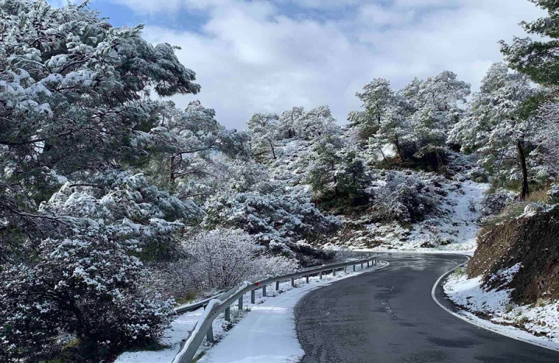
Yellow Warning is in effect, from the Department of Meteorology, while the cold holds well, with last night being considered the coldest of this winter to date. During last night the snowfall in Troodos was heavy, while as it was announced, The height of the snow in Troodos Square, at the time of issuing the bulletin, was 42 cm.
The cold will continue today, while from tomorrow Friday it will gradually subside to return a new wave of cold from Sunday afternoon.
Detailed weather today:
The cold gas mass, which affects the area, recedes from tomorrow, while low pressure is expected gradually from Saturday. Cold gas mass will affect the area again on Sunday.
Today the weather will be mostly clear, but locally there will be increased clouds at intervals. The winds will blow mainly westerly to northwesterly, in the leeward weak and in the leeward moderate, 3 to 4 Beaufort. The sea will be a little turbulent, while in the leeward up to turbulent and initially turbulent. The temperature will rise to around 12 degrees inland, around 14 on the coast and around zero in the higher mountains. Locally in the mountains the frost will remain.
Tonight the weather will be mostly clear, but locally there will be increased clouds, mainly on the beaches. The winds will blow mainly southwest to northwest, weak and locally on the coast up to moderate, 3 to 4 Beaufort. The sea will generally become a little turbulent. The temperature will drop to around 2 degrees inland, around 4 on the south and east coasts, around 6 on the rest of the coast and around minus 5 degrees in the higher mountains. Frost is expected locally, in the mountains, in the semi-mountains and later in the interior.
On Friday the weather will be partly cloudy and at times locally cloudy, while there may be isolated light rain and light snowfall, locally in the mountains. Late at night, local rains or thunderstorms are expected in the western half of the island, as well as snowfall, locally in the mountains.
On Saturday the weather will be partly cloudy and at times cloudy, while in the morning isolated rains or thunderstorms are expected, mainly in the west and south, as well as snowfall locally in the mountains. Local rains are expected in the afternoon, in most areas and isolated thunderstorms, as well as snowfall in the higher mountains. On Sunday the weather will be partly cloudy and in the morning locally cloudy, while local rains or thunderstorms are expected, as well as snowfall locally in the mountains. A gradual improvement of the weather is expected from noon, with isolated light rains and temporary light snowfall locally in the mountains and semi-mountains. Very strong and temporarily strong westerly winds will blow in the windward coast and mountains from the afternoon.
The temperature will rise on Friday, mainly in the interior and in the mountains, and not a significant change until Saturday, to fluctuate close to the average climatic values. On Sunday, the temperature is expected to drop, more noticeable in the afternoon and evening.


