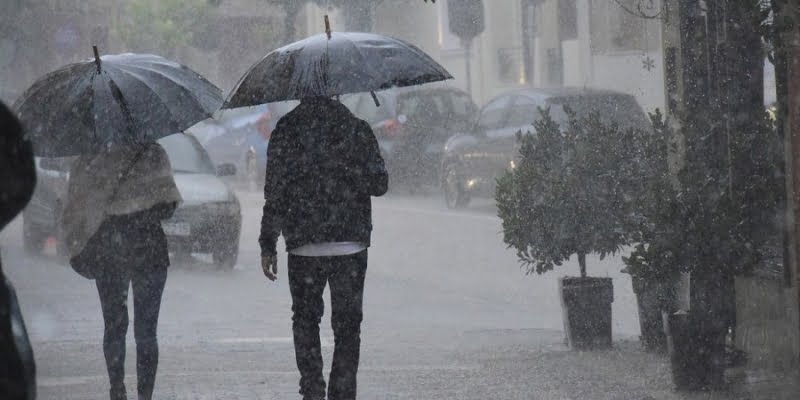
About the bad weather "EVA", which will affect Cyprus from Sunday evening, the Director of the Meteorological Service, Kleanthis Nikolaidis, spoke on the state radio.
First he explained that the name "ΕVA" was given by the Meteorological Service of Italy as the barometric low formed in the Gulf of Genoa deepened there. He explained that this particular barometer is associated with a large volume of rain.
He pointed out that the Meteorological Service of Greece has issued a warning for high levels of rain. “Such a barometer in 1969 resulted in the death of 20 people in Greece”. He added that such systems can bring destruction and loss of life.
He explained that the barometric pressure will weaken moving towards the eastern Mediterranean region. "The phenomena it will give us will be during Monday with rains and local storms throughout Cyprus".
He clarified that so far no warning has been issued, while the bad weather is expected to weaken on Tuesday.
The weather forecast:
Light barometric pressure affects the area, while the barometric low with the name "EVA" approaching from the west, begins to affect the area from late Sunday night.
Today, after the dissolution of the local low clouds, the weather will become mainly sunny, while during the noon and afternoon hours, locally increased clouds will be observed which are expected to give isolated rain and a possible short storm mainly in southwestern areas of Troodos. Winds will be variable gentle 3 Beaufort and the sea will be calm. The temperature will rise to around 27 degrees in the interior, around 25 on the coasts and around 16 degrees in the higher mountains.
Tonight initially the weather will be mostly sunny. Later, increased low cloud is expected mainly in the west and north, while local light mist or fog is expected to form inland and east. Winds will blow northwest to northeast and on the northern coast southeast, weak 2 to 3 Beaufort. The sea will be calm and later locally up to a little rough. The temperature will drop to around 11 degrees in the interior, around 15 on the coasts and around 8 degrees in the higher mountains.
On Sunday, from midday onwards, locally increased clouds are expected to bring isolated, mainly light, showers to the west, while late evening isolated showers and isolated thunderstorms are expected to affect mainly the western and northern coasts.
On Monday, from the morning hours, isolated rains or storms are expected mainly in coastal areas, while later on intermittent rains and local storms are expected, with the effects initially affecting the west and gradually expanding to other areas of the island. Local effects are likely to be severe. On Tuesday, increased clouds are expected to give isolated rain mainly in the east, in the north and in the mountains.
The temperature is not expected to change significantly on Sunday, to remain slightly above the average climatic values. A drop is expected on Monday, and an insignificant change on Tuesday, to range close to and slightly below the average climatic values.


